Saturday, August 20, 2005

Guests

If you are 'just tuning in' as they say on TV, Welcome! I apologize for the self-centeredness (and for the grammar) of this page. It is meant as a convenient way to share some experiences and photo's with my friends, not as a monument of me.

Newer posts are at the end, so scroll down or go back into the April Archive, which will start with a trip into Mexico in April this year.

Feel free to leave comments on any of the posts/photos, or to email me direct at RAMasters@comcast.net

Thanks for looking in!

Randy

What's the Point?


Ever since I put the R80GS up in Colorado Springs for the summer I have been talking with my 13 year old daughter about joining me to experience the wonders of riding in Colorado. Convincing her didn't take too much work - I think she's gotten a touch of the 'bug' already - but getting Mom (aka COMKITCHENSINC) to approve took many lively discussions a new helmet, ballistic riding jacket, m/c gloves and boots. Worthwhile activities like church mission trip and choir tour were roadblocks in the schedule, and with school coming up it began to look like we were going to lose our window of opportunity. Finally, however, it all came together, the date was set for the weekend of Aug 6-8, and I began to plan.

I planned several different routes in different directions to allow for weather, interest (or lack thereof) and comfort. This would be Emily's first trip away from home on the bike, her first camping trip, and her first time in Colorado. That's a lot of firsts for 3 days, and while I didn't want to over-do it there was so much I wanted to share with her. I planned to go north to Rocky Mountain National Park. I planned to go west to Aspen and Independence Pass. I planned to go south to Trinidad and Cordova Pass. I planned rest breaks and meals and camping, points of interest and scenic overlooks. My ROADS OF COLORADO was tattered and scarred and thumbed into translucence.

But as Dwight Eisenhower once observed: Planning is important, but plans are no good once the bullets fly.

We arrived at the DFW airport (you know, the one on which BOTH Dallas AND Ft Worth agreed) in time for the first flight out at 0845, no mean feat for a 13 year old girl on a Saturday morning. We checked one large duffle and carried on only a small backpack/purse with 'essentials'. I was proud of the way she had pared down her packing list and then suffered my picking through it further until it would fit on the bike. Note: I left the eyelash curler IN for this trip to avoid too much shock at once. I was also proud of the way she smiled and chatted with the ticket and gate agents. Unfortunately no amount of charisma would get us on the first 2 flights, so we spent the first 1/2 day of our vacation (and at $5.50 a Hagen Daas Bavarian Chocolate Sunday the most expensive half a day) waiting to get seats. Finally we arrived at the U-store-it at 1600L (4pm Colorado time). Now Plans had to change.

The idea of Planning is to accomplish the task at hand. One has to distill all requirements into a single point and make that happen. So, now faced with only 2 days and a new rider I had to rethink what the point of this vacation was to be. It wasn't really riding, and it wasn't really sightseeing. It was to spend time with my daughter while I still could, while riding in beautiful Colorado. Where we went, what we saw, what road we took was secondary to the opportunity to get a better picture of the young woman (oh, gasp) that she is growing up to be.

The first day we visited Pikes Peak, battling a touch of fatigue and altitude sickness, and talked about how cold it was, how beautiful it was, and how her older brother and I had had the same problem when he there with me ten years ago. Then we traveled up 24 to 67 and Mueller SP to camp - but were told it was full and we couldn't even go in to check. So we regrouped and went up a dirt road until we found some 'free' camping. She did a great job of hanging on to the bike and to the sleeping pads lashed to the saddlebags over the rough road. That night we talked about the other girls in her Jr Hi class, and what the boys on her summer choir tour were like, and how cold it was really going to be.

Second morning we took pictures of wildflowers and then headed into Cripple Creek for pancakes, a ride on the narrow gage railroad, a visit to the mining museum, and discussed why grandpa is sharing his memories so frequently these days, why we listen, and what its going to be like when he can no longer tell us these tales. We rode the loop thru Victor and Terr81 back up to 67N and 24, then at Woodland took 67N to Deckers, where we stopped for cokes and conversation at a convenience/coffee shop with a dozen other scooters. It was fun to watch her cultivate conversation with strangers - beginning only with the of a color of motorcycle (purple - don't ask me!) for a seed. Then we followed the Platte River up to Buffalo Creek in search of gas. I passed up the pump, but she spotted it next to a 1893 general store, showing she was more than just a passenger (from the word 'passive') on this trip. The old gent on the front step was the father of the middle aged woman currently running the place - which had been in the family since 1900. It was complete with mailboxes and hardware, fertilizer and female products, butchered meat and canned goods. After an expensive but worth the entertainment fill-up we returned to Lone Star Campground, just outside Deckers, and she showed off her newly acquired ability to set up the tent and lay out the sleeping bags, while I unloaded and set about cooking dinner. That night we hiked along the river, scaled cliffs, discussed the optimum distance between shirt bottom and pants top, and why dad gets so picky about how low hip-huggers ride these days.

Final morning we took off to the north on 67 towards Sedalia, where we would join I-25 back into Colorado Springs. We needed to further curtail our ride due to family medical issues back home. By the way, sex-ed and health at school are fine, but an 8-month pregnant older sister provides much more fodder for discussion, as does the possibility of cancer in a 43 year old aunt. That's a lot of fat to chew, but fortunately you only have to nibble on it a little at a time each stop for gas, restroom, or directions. The route was terrific, up to I-25 and the cut-through to the U-store-it, and I recommend the area for canyon carving, cruising, fishing, or general relaxing in the COS/DEN area. We stuffed the duffel, caught a cab, and even made the first flight we tried with side-by-side first class seats (yeah, the life of an airline pilot).

We didn't go far north, or west, or south; in fact we only traveled 250 miles total. We didn't see the RMNP or Mt Elbert or herds of Elk. We did get the chance to leave computers, tv's, telephones, cd's, and all the other distractions of family and home behind us for a while and concentrate on talking with each other.

And that, friends, was the point of it all.

Tuesday, August 16, 2005

Cool Down Part Deux

Day 4

This day I decided to head in a different direction, like so many of my BMW brethren and sisteren. I joined the morning's swarm at a gas station just outside Paonia on 133S, heading towards Hotchkiss. As usual I was amazed by the variety of styles we BMW riders embrace. F, R, K. Denim, leather, cordura. Sport, Tour, G/S, Hack. All scattering like bees in search of pollen, to return to the hive swollen and drag assed tired at the end of the day looking for a kind caress from the queen. But I digress.

Out of Hotchkiss I rejoined 92 to Delta and then went north on 65 past the unremarkable towns of Orchard City and Cedaredge, just ho-humming along until 4 miles later when it became a series of switchbacks up to Grand Mesa. or Mesa Grande. Or Uperthingunmatwt which, on the Ute Indian tongue means, romantically, Land of the Departed but on my tongue sounds like I've burned it with too hot coffee. I took a moment at Crag Rest Park to enjoy the view to the south, looking out over Delta/Montrose in the Uncompahgre Basin. In my moments of reverie I became both host and lunch to hundreds (thousands?) of frantic mosquitoes trying, as all living things in this region, to make the most of the temperate months for feeding and reproduction before hibernation or death - a life style I find appealing in it's simplicity. Perhaps that explains the feeling I get at treeline and above: a sort of urgency to make the most of what is available for the brief time it is possible to do so. Around the mesa are numerous lakes with names like Deep Slough, Hotel (and Upper Hotel) Lake, Island Lake, Devil Lake, and such spotted with fishermen and fisher boats. While the inertia of my route took me further north on 65 to its juncture with 330, I should have explored east and back on the FR roads - FR123 in particular looks like the appetizing something on the menu you vow to try 'next time'. 123 appears to join FR121 which could take a rider north into Colbran by the back door, somehow changing into '50.00 road' (?) in the process. But then I'd have missed the big whoop-dee-do down hill curves on the north side of the Mesa.

330 travels in one direction - east to the town of Colbran. Large enough to support a gas station, burger joint (boasting service since 1988 - like it was a different century or something. Oh, wait....), and a nifty mid-town cultural section. Cultural Intersection, really. I mean it's basically a left turn with a coffee shop and small screen movie house, but that has to have SOME cultural value, right? It was at the gas station I measured the town's isolation -not on the universal telephone-scale of service/roaming/no service/open piles of burning garbage, but rather the Colorado Specific Scale of number of dogs in the bed of the truck. This was a 4 dog town (zero meaning urban or high speed driver no tailgate), with a small deduction for the dog in the cab not only being collared but of a recognizable pedigree small enough to be considered at risk from the 4 in the bed.

Beyond Colbran it seemed a long way back on dirt FR265, but only because it traversed so many different types of terrain - from church-camp-like woods to isolated hollows to pastures complete with cow herds and cow hands. Real cow hands; dirty and tired because they're still in the saddle working and haven't yet washed, not dude cow hands; dirty because they're so tired from the thought of work that they just don't care anymore. Lots of 4 wheelers, too, by the way. That seems to be the new menace in the area - folks who trailer up a, ah, trailer-load of the noisy bulbous tired beasts and then wreck havoc on the dirt roads; when dry by spewing clouds of dust which seek out every surface and orifice and when wet by creating oddly spaced ruts directing narrow motorcycle tires in the shortest direction towards the nearest drop-off or bog.

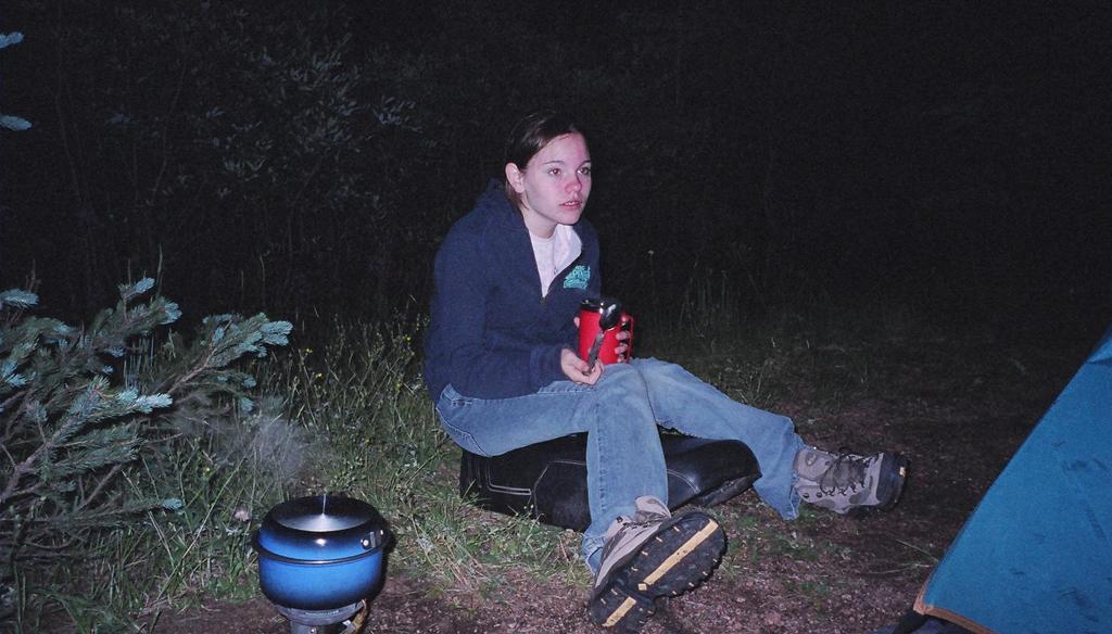
FR265 does find 133 again, north of Paonia, so after a few yards of slinging dirt and mud off the tires (and scaring the hell out of myself on the first curve for that reason) I returned for the end of Rally drawings and awards, BBQ dinner, long sets by the loudest band so far and continued great service by the American Legion at their temporary post by the beer tap.

Day 5

In case you are curious, there's no need to set an alarm for the last day of a rally, and you can sleep well with ear-plugs and still rise at an early hour. How? Why? Last night's efforts by the AmLegion and the need by some to be on the road early will ensure a non-stop banging of the port-o-let doors beginning before dawn. But that's as it should be; people have many miles to go, again, in every direction but the one directly home. Tent city rapidly returns to city park lawn, pock marked by ground cloths and temporary trails. HUGE tents and their accoutrements pack into incomprehensibly small packages which, in turn, get tucked into and strapped onto the nooks and crannies of hundreds of bikes. Hands are shaken, waists hugged, promises made, and the last pancake given out. It's time to go home, there's no more syrup.

I didn't intend to ride all the way back to the Springs in one day. After all, my kitchen pass was good for two more, but it seems once set in motion I would continue to roll back towards the u-store-it, the airport, and home. Ah, but first.....
Back up 133, through Somerset, to the Kebler Pass cut-off. My son John E. and I traveled this road on my R65 with street tires a few years ago - let's see how much different these Avon Gripsters feel. A lot, it turns out. Certainly the GS clearance and suspension help too, but I maintain a good old standard bike like the R65, or a /5, /6 or /7 should have no qualms about traveling dirt roads, here or in Mexico (see my article on Batopilas) in dry conditions. A less aggressive pace is required, surely, but the scenery and more direct routing will make up for a reduction in speed.

Through Crested Butte onto 135 south towards Gunnison I almost missed the aptly named Jake's Cabin Cut-off (less colorfully also called '8 Road') for Taylor River and Almont. FR742 follows the Gunnison River to the Taylor River, past Almont to Taylor Reservoir and by the looks of the map SHOULD be dirt, but is, in fact, smooth surfaced asphalt dipping and twisting along the water's edge. It is also heavily wooded, bounded by campsites, and sometimes clogged with campers and RV's, requiring a certain amount of restraint and a deliberate and delicate decision on when to flex your 2 wheeled muscle. That aside it is a BEAUTIFUL section of road for a vacationer - a destination in itself.

Past Taylor Reservoir is Cottonwood Pass Road which crosses to Buena Visa over, ah, Cottonwood Pass, elevation 12,126', and is graded dirt west of the pass and paved east of it. The pass itself is very similar to Independence Pass, just north of here on 82, and has deceptively simple looking hikes on either side of the road to solitary lookouts. Well worth the lung busting vision blurring blood oxygen depleting climb. In fact, take as long as you must, latch onto some frenetic pre-teen (if you can catch one as it goes by) to drag you, but don't miss the opportunity for unobstructed contemplation of the wondrous mountains around you.
Buena Vista is reality's slap in the face with traffic, gas stations, tour buses and fast food joints, but that's probably a good thing to wake you after the above euphoria. Here I joined 24 South and or East towards Colorado Springs, following a brother Harley Rider across the flats. Well, maybe an estranged brother with whom I've lost touch. In fact, I don't think we talk at all any more. Rolling into the Divide/Woodland Park area I offered my talisman to the rain god and don my gear, which appeases her and the heavy downpour becomes just a series of showery mists which stop as I arrive at the storage area.

In a rush to catch a flight I re-move, re-sort, and re-pack - while the cab searches for my location ("at the storage area? Like, IN a storage unit? What is this, a crank call?"). While checking in at the ticket counter and engaging in polite conversation with the agent suddenly the little voice in the back of my head screams out KEYS! YOU FORGOT YOUR CAR/HOUSE KEYS BACK AT THE U-STORE-IT!!!). A mere 35$ round-trip cab ride later (on top of the 15 + tip in the first place) and I'm finishing my chat and receiving my boarding pass. Still cheaper than riding home, buying a ticket, or paying for a locksmith (twice). Yes, I now leave spare keys hidden on the VW camper, just as on my bikes. No, I won't tell you where!
It was a grand time!

Thursday, August 04, 2005

Colorado Cool-Down

Day 1

For my second sojourn into Colorado this year I unlocked the door of the storage unit and headed north to check out Rocky Mountain National Park on my way to Paonia. It's a funny thing about BMW riders - we can't seem to get from here to there in a straight line - it's as if we have directional dyslexia. CO24 or Platte Rd passes the storage facility and goes into Colorado Springs, where it disappears into a maze of urban one-way streets and dead ends before joining I-25North. Next trip I'll take 83 and bypass it all northbound.
Heading to Denver is the same old same old interstate ride we all love and avoid whenever possible, so at Castle Rock I detoured onto 85 and 470 to circumvent downtown Denver. Then I shot out 70W for a bit to 72N and some 'real' riding. The map shows lots of squiggles on 72, and it's on the eastern slope of the front range, so even though I don't recall any particularly stunning bits, it's a sure bet it beats anything I could ride in Texas! It passes through Nederland, where I stopped for lunch at the First Street Cafe and Bar. I was hoping for a little more conversation than the solo waitress/barmaid was able to indulge, and not being a local was basically isolated by the rest of the clientele. At least the burger and brew were good, for 16$. 72 hits 7 which took me into Estes Park where the REAL fun began when I paid my 10$ (per rider for motorcycle) and got on 34 into the RMNP. up, Up, UP I went and round and round. The air got cooler and cleaner with each passing moment and the views - well, spectacular! Traffic was light but coupled with the narrow-ish road enough to keep my speed down, so I enjoyed sightseeing. It was late-afternoon and the critters were starting to come out and reclaim their land. I saw marmonts and chipmunks and deer aplenty, and when I reached the Alpine Visitor Center at the top (elevation 11,786) a herd of Elk had decided that enough was enough and had brought traffic to a standstill as they crossed the roadway. Remember people: Calm does not equal Tame! Putting a child in close proximity of a 500lb+ wild animal for a photograph is not a good idea! Coming down the backside (western) of the park I crossed the Continental Divide and took the obligatory photo before terminating my days travel at Timber Creek Campsite.
The Campsite was supposed to be full - some rally or another, but I took a chance and rode through anyway. 1) there's usually a solo who'll share tent-site and the 20$ fee or 2) there's an overlooked opening you can snag. I found the latter and paid the 20$ to set up next to Larry, from Golden, riding an R1150GS (already sharing a site). Across the way was a couple from New Zealand on a 6 month holiday in a Subaru with 2 mountain bikes and a cargo box on top. They had been out long enough to have the routine down pat but not so long that they couldn't stand to be around one another. Nice balance. I told them I'd give them the roomy tent, the dual burner stove with steaks and the bottle of wine, but any form of PDA (Public Display of Affection) would not be tolerated. Campsite operators were, frighteningly enough, a retired couple from Burleson TX. Full time RV'ers they took the summer 'job' and love it. Come winter they'll head back to lower and more southerly lands chasing the perfect temperature.


Day 2
I followed Larry's suggestion the next morning and finished 34 out by Granby, then went west on 40 to 134 and south on 131 to Wolcott near 70. It was the gold in the ground that drew people out to Colorado, and there's still a lot of money in the mountains - now in real estate. Wolcott's little gas pump/diner was a haute couture affair with 15$ breakfasts and 3.50$ espressos and a fellow who proceeded to tell me that airline pilots didn't deserve the money they made and the whole airline mess was their fault and the fault of the unions. He'd earned his money the hard way in the auto business in Houston, sold it all for the real estate value, and now was a developer in CO. Just about put me off my huevos. I declined his suggestion to tour his million dollar sites, and took CO 6 (which parallels 70) through Eagle to Gypsum and then went dirt southwest to join 82 at Cattle Creek. It was neat for me to ride my bike past Eagle Airport, where, as an overpaid airline pilot, I have landed a 757 with 188 trusting passengers in swirling crosswinds and threatening stormclouds streaming between 14,000 peaks on a runway that was still 10 times longer than the aircraft carrier I flew off while deployed in the Indian Ocean. But I digress. My map was somewhat vague about the dirt road I took out of Gypsum, but by following the tire tracks and favoring the heavily trafficked forks I managed to become totally lost, hitting pavement again with about 30 miles left before reserve and a deep regret over not filling the extra fuel bottle at the last gas station. Money in the Mountains? I passed one place big enough to be a Scientology Lodge but which was actually a private residence doing a little add-on - complete with a helo-port and Jet Ranger in back. 82 hooks up with 133 at Carbondale, and there I began seeing a more steady stream of riders heading for Paonia, some 60 miles south. 133 is a memorably beautiful road, with twisties aplenty and tremendous scenery. There's one little town that always stirs my emotions, though - Somerset. You know you're there when you see the coal chutes and elevators. Posted in town are signs which state: UMW-Here to stay, and UMW - United for you! The houses are of the post WWII cookiecutter style and perched right onto the roadway. It is, perhaps, the sole location on my trip that didn't say to me "I could live here". Just the opposite. Each time I pass through it I am gripped by gratitude for living somewhere, anywhere, else. Even Texas.
Pulling into Paonia is like turning into your driveway at home - just that kind of welcome back feeling. The BMW Club of Colorado has been coming here for over 20 years and sharing an appreciable portion of the gate with the local organizations - not to mention the boost to the merchants in town. Town Park is ours and rapidly becomes tent city, with the nerve center being the Teen Center where registration, bathroom, shower, diner, wi-fi port, and Cafe all come together under one roof. Next in line would be the Beer Station/Dance Hall, manned by the good men of the American Legion. Buck a Beer. God Bless 'Em. And the music goes on 'till you quit dancing. The trick, I've found, is to scout a tent site equidistant from the porta-potties and the beer (but definitely NOT on the direct line) and as far away from the band and the streetlights as possible. Arriving on the first day (Thursday) of a four day rally is perfect!

Day 3
In round one several years ago, I fought to a draw with the Alpine Loop out of Lake City, just south of Paonia, ham-strung by my fully loaded R65 with street tires. Now, astride a real paved road/dirt road machine with my bags back at the park I was counting on a rematch, and headed down 92 towards Blue Mesa Reservoir. Along the way I stopped for a hour's hike out Crystal River Overlook to enjoy the clear day and tremendous vistas. Barely on the other side of the reservoir was a dirt cut off - Lake City Cut-off, in fact. The geography of Colorado is such that major roads, with few exceptions, parallel the crests and valleys, meeting only when allowed by terrain - which can make getting from here to there a long proposition. Human nature is to take short cuts, so these dirt roads are the answer. This one was very well graded, no loose bits, and provided solitude and wide open spaces (to quote the Dixie Chicks) before it met up with 149 heading into Lake City. This section is ABSOLUTELY spectacular, following a stream as it bounces and pools and flings itself down the valley. Any number of technical curves, and an infinite number of mental photographs to file in my mental screen savers for later.
The ends of the Alpine Loop meet in Lake City, and I took the first one I came upon. It starts out like the other dirt roads, well graded and firm, as it winds up into the mountains following a small stream. This stream provided power for a mine some 10 miles up road - a great photo shoot and place to take a break to look around. That 10 miles and the next 6 or so remain well ride-able by any bike, but at 16 miles the warnings start about 4 wheel drive road not maintained own risk, etc. And the road begins it's climb up to Engineer Peak and snow. 15' of snow bank along the road at the pass! 4-wheelers blast back and forth, throwing up a dust storm, like Pig Pen when he runs, that has turned the white snow a beige, but just scrape or grab a handfull and it is indeed the cold white stuff.
It seems every time I feel the big dog, the universe reaches over and kicks the legs out from under me. Think a '72 /5 is old? here's a '53 R27. Riding sidecar? oh, here's a guy with a hovercraft. Puffed up about riding over a 12,000' pass on your 800cc 20 year old motorcycle? How about meeting a guy on a 30 year old Honda 500CT. With his wife. And his dog. And he's come around the OTHER pass.
Instead of continuing around the loop back to Alpine, the lack of oxygen and threat of rain in that direction made me track straight across (short cuts, remember?) towards 550 the million dollar highway just south of Ouray. This was definitely the toughest part of the trip and the toughest riding I've ever done. Flanked by a drop off on one side and rock face wall on the other, you have to navigate over loose rocks, large and small, thrown over solid rock base resembling irregular stairs. At the very end (beginning?) where it meets the road, the final 100 meters is loose rock scree I suppose is designed to stop foolish first time dirt riders from even taking their bikes off the trailer. It would have worked for me - had I done the trip in the other direction I doubt I'd have made it up to the first turn.
550 needs no introduction or description. It's too famous for the former and defies the latter. I dogged up through Ridgeway to Delta, turned right on 92 toward Hopkins, Paonia, and a shower and beer.
It was a very good day.